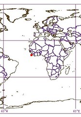
Guadalupe Island MX

Thursday, December 28, 2006

Guadalupe Island MX

I have wanted to map this island for quite some time. Landsat imagery was full of clouds, not good to map details of both shoreline and the island proper. I located some ISS imagery that was relatively clear. The resolution was crude compared to Landsat. Finally Google Earth managed to snag some 1-meter resolution Digital Globe imagery. I had the perfect image, now I just needed time, like Christmas vacation. I have worked on this map and the various layers for about 10-hours. The shoreline is as good as it gets. The northern end of the island is cloud obscured and I had to use ISS imagery to approximate the shoreline. However, the bulk of the shoreline is crystal clear.

Mapping in Google Earth is a challenge. In Marplot it is easy to create multiple features within the same layer (i.e., five Cypress Tree Groves). In GE, each feature stands by itself. I had to create five separate files for each grove of trees. The problem comes when you have many features (i.e., small islets ringing this island). I had to create 13 separate KML packets. Each had to be handled separately to reformat so that they could drop into Marplot.

This island was ravaged by a variety of feral animals, goats and rabbits primarily. The goats eat anything and everything. They were eating the Cypress tree seedlings. They were destroying this unique ecosystem. The Mexican government and US agencies have worked cooperatively to eradicate these feral pests. I noticed that the large stands of Cypress trees are ringed by fences. Reportedly, the goats are almost completely gone. The fragile ecosystem is recovering.

Not in our lifetime, but in our children's children, they will be able to visit a verdant forest that will cover the entire higher elevation of this island. They will stay in a swank lodge and for fun take long hikes. No, not in our lifetime, but perhaps our children's children will experience it.

Enjoy!

PS - The SRTM data was great, so I created 100-m interval contours. Now the map image contains the EVS Contours layer. And now I am finished with Guadalupe Island.

Labels: , , , , , , , , , ,

posted by Mr Minton at 1:29 PM 0 comments

Tatakoto Atoll FP

Wednesday, December 27, 2006

Tatakoto Atoll FP

Tatakoto (17˚20'S., 138˚25'W.) is a low atoll about 90 miles NW of Pukaruha that is wooded on the NW part. The lagoon is inaccessible from the sea, but a landing may be made near a flagstaff in a village on the atoll's W side.  (SD Pub-126)


TATAKOTO
THE TUAMOTU ARCHIPELAGO

Other names given by European discoverers: Augier, Narcisse

Tatakoto is located 1,182 kilometers (724 miles) from the island of Tahiti and some 180 kilometers (119 miles) from the nearest inhabited atolls of Vahitahi and Puka Puka; Tatakoto is undoubtedly one of the most remote atolls in the Tuamotu Archipelago as well as all of French Polynesia.

Geography

This bean-shaped atoll is 14 kilometers (8.7 miles) long and 3.5 kilometers (2.2 miles) wide. It is located at 17°20’ south latitude and 138°24’ west longitude.
Tatakoto covers an area of 730 hectares (1,804 acres) divided up into 65 islets, or motu. Its lagoon, which covers an area of 1,970 hectares (4,868 acres), is 11 kilometers (6.8 miles) long and 2.5 kilometers (1.6 miles) wide. The biggest motu is 15 kilometers (9.3 miles) long and 400 meters (1,312 ft.) wide, covering the entire north coast of the atoll in an east-west direction. The southern side of the atoll is exposed to prevailing winds and is composed of a series of motu separated by small passes. The biggest motu has an unpaved runway that is practical for flying out copra. The village of Tumukuru is concentrated on both sides of the main road and along the coconut plantation road, an overall area measuring 600 meters (1,969 ft.) long by 200 meters (656 ft.) wide. Six main streets crisscross the village of Tumukuru, which is located on the western point of the atoll. Tatakoto has an aerodrome located near the village, but the atoll does not have a pass through the coral reef enclosing the lagoon. The village has a whaleboat dock and a 25-meter (82-ft.) pier. A second whaleboat dock is located in the southern part of the atoll.

History

Two Spanish explorers—Domingo de Boenechea and Andiay Varela—sighted Tatakoto independently of each other on the same day in 1774, becoming the atoll’s first European discoverers. From 1900 to 1927 Frenchman Albert Javelot served as the atoll’s chief, planting the atoll with coconut trees that still cover the atoll today. The 1996 census recorded a population of 247 persons.

(From Presidency of French Polynesia Web Site)


Atolls are both satisfying and frustrating to map.  They take hours to complete.  This atoll consists of 13 identified layers and another 4 additional layers.  Each layer of information requires consistent identification and delineation.  Each atoll's EVS Reef Middle, for example, should be consistently identified from the Landsat mosaics used as base imagery no matter the island.  The steps to create a map such as this are both tedious and demanding.  Now for the good stuff - the finished map looks great!  It not only looks great, it is a solid cartographic effort.  Even before I began this project, I knew that ultimately the finished product would look great.  The base imagery is clean and provides a crisp picture of the atoll.  The challenge was to keep working.  And that is just what I did.

Enjoy! 

Labels: , , , , , , , , ,

posted by Mr Minton at 11:26 AM 1 comments

Swains Island AS

Swains Island - Image

Swains Island - Landsat Image S-02-10_2000 (1:25,000)


Swains Island - Map

Swains Island - Marplot Map (1:25,000)


The entry in Sailing Direction Pub-126 is merely to state the name of the island and it's location. The better information comes from Jane Resture's site and a US DOI site. So I won't rehash what they will tell you. The island sounds like a great place to visit, except for the flies and mosquitos.


The map was relatively fast to construct. It took about 3-hours from start to post. I did a change for the vegetation layer. I made it less "lime gree" and more of a "muted green". It is easier on the eyes.

Enjoy!

Labels: , , , , , , ,

posted by Mr Minton at 11:24 AM 0 comments

McKean Atoll KR

McKean Atoll - Image

McKean Atoll - Landsat Image S-01-00_2000 (1:10,200)


McKean Atoll - Map

McKean Atoll - Marplot Map ()1:10,200)


McKean Island (3˚36'S., 174˚08'W.) is a treeless coral island, nearly 0.5 mile round in shape, set on a heart-shaped reef. Breakers extend about 0.3 mile from the N end and 0.2 mile from the S end of the island. The most conspicuous object on the island is the ruin of a large building on the W side, with a coral slab, 2.1m high. Scattered about are the ruins of several structures, obviously part of the old guano works. The island is a wildlife sanctuary.

Winds—Weather.—The winds are nearly always E, varying from NE to ESE, with the former predominating.

Tides—Currents.—The current sets strongly past the N and S points, converging on the W side of the island. Close in to the shore on the W side, the flood sets N and the ebb S. Offshore, the set is W with an average velocity of 0.5 knot, but varying in strength and direction with the prevailing wind. (SD Pub 126)


I mapped this island because of a reference to it in the Atoll Research Bulletin. This map took about 1 hour to complete and post. It's lagoon is classified as a EVS Wetland, because I don't have an appropriate layer designation yet for a lagoon of this nature. It is mostly full of salt tolerant vegetation and rubble. At high tide the lagoon has ocean water percolate into it. Atoll Research Bulletin 228 contain some interesting information about a brief scientific expedition to the island back in 1968. The information is still relevant.

Enjoy!

Labels: , , , , , , , ,

posted by Mr Minton at 11:22 AM 0 comments

Birnie Atoll KR

Birnie Atoll - Image

Birnie Atoll - Landsat Image S-02-00_2000 (1:14,000)


Birnie Atoll - Map

Birnie Atoll - Marplot Map (1:14,000)


Birnie Island (3˚35'S., 171˚31'W.) lies about 43 miles S of the S extremity of Canton Island. The island is 3.6m high on the rim, sloping gradually to sea level at a shallow brackish pond located about 90m inland from the E side of the island. Birnie Island is a bird sanctuary.
A flat fringing reef, drying at LW and extending as far as 0.1 mile offshore, surrounds the island. A shoal, which breaks in heavy weather, extends 0.7 mile S from the S point of the island. A stone monument on the E side of the island, about midway of the length, is visible 6 miles and is a radar target for the same distance.

Tides—Currents.—Close into the W shore the current sets N. Farther off, the set is W and is usually at a rate of about 0.5 knot, with the strength and direction varying with the surface currents set up by the prevailing wind.

Anchorage.—Anchorage is possible about 0.3 mile off the NW point, in 16.5m, with E winds. The S spit is considered too dangerous for anchorage, as it drops off from a depth of 3.7m to 54.9m within 90m. (SD Pub-126)


This map was quickly constructed (2-hours). However I came up with two new layers - EVS Brackish Water (which describes brackish water lagoons that are fed through percolation of sea water) and EVS Uplifted Reef & Scrub Vegetation (which describes island surfaces that have tufts of vegetation and little sand). The image file was taken from Landsat ETM+. I got spoiled on my last island (Nikumaroro Atoll) working from Ikonos imagery. 1-meter imagery is sweet!

Enjoy!

Labels: , , , , , , , ,

posted by Mr Minton at 11:20 AM 0 comments

Enderbury Atoll KR

Enderbury Atoll - Image

Enderbury Atoll - Landsat Image S-02-00_2000 (1:31,250)


Enderbury Atoll - Map

Enderbury Atoll - Marplot Map (1:31,250)


Enderbury Island (3˚08'S., 171˚05'W.) is a coral island consisting of a rim averaging 3.9m high, with a sunken central plain about 1.2m above sea level. The island is steep-to, with a very short reef which makes landing difficult because of the strong sweep of the undertow on the shelving shore. The shelf extends only about 68.5m and drops off rapidly except at the N and SE corners.

Winds—Weather.—The winds vary from the NE to SE. There are frequent, but usually brief rain squalls and they cannot be depended on as the sole water supply.

Tides—Currents.—Immediately W of the island, the current sets to the S with a strength of about 1 knot. In very strong flood tides this set may be reversed. Clear of the island, to the N or S, the average set is about 0.8 knot in a 255˚ direction.

Aspect.—A mast, marked by red obstruction lights, exists about 0.8 mile S of the N extremity. The most conspicuous objects on the island are several palms at the N end; a large guano heap, about 6.1m high on the W side; and the buildings of the settlement at the S part of the island.

Anchorage.—During the season of the Southeast Trades, there is opportunity to anchor on the spit off the NE point, in depths of 45 to 55m, coral and sand. The anchorage should be approached slowly from the WNW with constant use of the depth sounder, as the spit is very narrow and may be overrun easily. The observed set of the current at this anchorage is to the NW, which keeps the stern away from the shore. Anchorage here is not recommended when the Northeast Trades are blowing.

Directions.—The landing place is on the W side of the island, just N of the settlement. Ships may approach the island to within less than 0.8 mile at this point. Landing may be affected by a surfboat through a channel in the reef leading in on a range of two beacons, in line bearing 092˚. Great care must be used in landing as the reef is short and steep, and the channel is narrow with rapid shoaling toward the landing. The best landing conditions prevail at HW and with a strong E wind, which flattens the swell that usually sets in from the S. (SD Pub-126)


This project was relatively fast (2-hours). I am having fun working on these little islands. They are relatively uncomplicated. Most of them are Bird Sanctuaries and are Protected Areas that require approval before you can land. People tried to mine a low-grade of guano for a few years. Now the island is home to birds and feral cats.

Enjoy!

Labels: , , , , , , , ,

posted by Mr Minton at 11:17 AM 0 comments

Rawaki Atoll KR

Rawaki Atoll - Image

Rawaki Atoll - Landsat Image S-02-00_2000 (1:12,500)


Rawaki Atoll - Map

Rawaki Atoll - Marplot Map (1:12,500)


Rawaki Atoll (3˚43'S., 170˚43'W.) aka Phoenix Island is a treeless, triangular, coral atoll surrounded, except for the middle third of the W or longest side, by a wide platform reef. The reef bares at LW. Depths of less than 9.1m are found within 0.25 mile of the SE and NE sides. Shoals, which break heavily, extend about 0.4 mile off the NW end of the island. The land rim is about 4.9m high, 30m inshore from the reef. The first rise is covered with loose coral fragments washed in from the sea. The island is uninhabited. It is a wildlife sanctuary. Phoenix Island has been reported to give good radar returns up to 11 miles.

Winds—Weather.—Winds are always E. Usually, they vary from ENE to ESE, with the latter predominating.

Tides—Currents.—The current sets strongly past the N and S points of the island, converging on the W side. Close in to the shore on the W side of the island, the flood sets N and the ebb sets S. Offshore, the set is W about 0.5 knot, varying in strength and direction with the surface currents set up by the prevailing wind. (SD Pub-126)


This took about 1-hour to digitize, convert into a map, copy images, post to Flickr and finally post to EVS-Islands. The northwestern part of the island is obscured by clouds. I could detect the faint outline of the island proper, but I guessed on the shape of the beach.

Enjoy!

Labels: , , , , , , , ,

posted by Mr Minton at 11:15 AM 0 comments

Manra Atoll KR

Manra Atoll - Image

Manra Atoll - Landsat Image S-02-00_2000 (1:31,250)


Manra Atoll - Map

Manra Atoll - Marplot Map (1:31,250)


span style="font-weight: bold;">Manra Atoll (Sydney Island) (4˚27'S., 171˚15'W.) is a triangular atoll located about 54 miles SSE of Birnie Island. The land rim of the atoll is about 4.6m high, and is covered with brush and trees entirely enclosing a circular lagoon. The island has been reported to give good radar returns up to 7 miles.

Winds—Weather.—The winds at Manra Atoll are almost always E, those of the SE quadrant predominates.

Tides—Currents.—Off the island, the set is W at a rate of about 0.5 knot, varying in strength and direction with the prevailing wind. Close inshore it conforms to the shoreline, diverging at the E extremity and converging at the W extremity.

Aspect.—With a NW wind blowing or at LW, it is better to land on the S side just E of the island. At this point, there is a fissure in the reef wide enough for a boat to enter if properly handled. The passages were reported improved by blasting.

Anchorage.—There is anchorage off the W side of the island, in about 16.5m, about 0.1 mile off the reef sheltered from the prevailing winds. From November to April, NW winds may be expected replacing the prevailing E winds. (SD Pub-126)


Again, this project was fast due to the small size of the island. The lagoon was somewhat complicated. However, the method to complete was steady efforts. I probably spent a total of 2-hours on this map, along with the posting.

Enjoy!

Labels: , , , , , , , ,

posted by Mr Minton at 11:13 AM 0 comments

Orona Atoll KR

Orona Atoll - Image

Orona Atoll - Landsat Image S-02-00_2000 (1:50,000)


Orona Atoll - Map

Orona Atoll - Marplot Map (1:50,000)


Orona Atoll (Hull Island) (4˚30'S., 172˚10'W.) is a coral atoll surrounded by a flat fringing reef, which dries in patches and is about 270m wide. The shelf drops off quickly except at the E extremity, where there is a least depth of 110m, 0.4 mile offshore. At all other points, the 200m curve is within 0.3 mile of the atoll.

The land rim of the atoll is about 0.3 mile wide and encloses a large and relatively clear lagoon. On the SE side of the atoll there are some passes from the lagoon to the outer reef which are fairly deep at HW, but there is no communicating channel through the reef. It was reported that the passes in the reef were improved by blasting.

At the W end of the atoll there are coconut palms from 12 to 18m high; the remainder of the atoll is covered with palm trees and brush, 6 to 12m high. There is a village in ruins on the W part of the atoll.

The lagoon has depths up to 14.6m and 16.5m in places, but it is foul, with numerous shoal coral heads. The larger and shallower heads have been marked with buoyed gasoline drums.

Tides—Currents.—Close into the shore, the current sets W along the atoll with an average velocity of 1 knot. Offshore, the set is W about 0.5 knot, varying with the surface currents set up by the wind. The tidal current in the blasted channel through the reef in the NE part of the atoll is very strong, ranging up to 5 knots.

The E channel, the widest and deepest, carries about 0.9m of water at the spring tides. A channel has been blasted through the W extremity of the reef.


Anchorage.—There is anchorage for small vessels in E winds only, in a depth of about 18.3m, about 0.1 mile off the W extremity of the reef. It is recommended that vessels with a draft of more than 6.1m lie off the W end of the atoll. (SD Pub-126)


The digitizing of this atoll was completed over a period of 2-days. The map took about 6-hours to complete. It took 3 seperate sessions to complete this project. The final session was from 3 to 6 in the morning. When you get started on a project it is tough to stop.

Enjoy!

Labels: , , , , , , , ,

posted by Mr Minton at 11:10 AM 0 comments

Nikumaroro Atoll KR

Nikumaroro Atoll KR

Nikumaroro Atoll (Gardner Island) (4˚40'S., 174˚31'W.) is a wooded, wedge-shaped atoll lying about 137 miles W of Orona Atoll (Hull Island). The atoll is surrounded by a fringing reef, which dries at LW, extending about 0.2 mile offshore. The NW and SE extremities of the reef appears to be extending. Depths off the atoll, which is steep-to except at its NW and SE extremities, average 366m, 0.3 mile from the reef. Nikumaroro Atoll (Gardner Island) encloses a lagoon into which there is no navigable passage. With the exception of two breaks, a large one on the W side and a narrow one on the S side, the land rim of the atoll entirely surrounds the lagoon.

The lagoon is encumbered with coral heads, but seaplanes have landed successfully.

A conspicuous stranded wreck lies close W of the N extremity of the atoll. The wreck was reportedly breaking up.

Tides—Currents.—Off the atoll the set is W, and varies in direction and strength with the prevailing wind. Close inshore, the current follows the trend of the land to the W. There is a deserted village on the W side of the atoll, about 1 mile S of the N extremity, off which anchorage may be obtained by small vessels, very close inshore. Two small beacons N of the village indicate the approach.

Directions.—The best landing place, marked by a white pyramidal concrete structure, is about 0.3 mile S of the village. A boat channel has been cut through the reef in a 054˚ direction and in line with the concrete beacon. Landing should be attempted just after HW when there is less surf than on a rising tide. With a SE wind, landing can be effected in the lee of the wreck at any stage of the tide. The reef is extremely slippery and wide, and the landing is not recommended if any equipment is to be landed or brought off. (SD Pub-126)


This is a redo of a previous post dated 2/25/2006. I wanted to bring in my current colors and include the standard images and maps (1:200,000, 1:100,000, 1:50,000 and 1:25,000). In addition, I wanted to show the Ikonos image that was used to help in digitizing the vectors that makeup this map.

If you have difficulties reading the Flash presentation, go directly to my Flickr account and check out the set of images with the same name as the title of this post.

Enjoy!

Labels: , , , , , , , , , , ,

posted by Mr Minton at 11:07 AM 0 comments

Canton Atoll KR

Canton Atoll - Image

Canton Atoll - Landsat Image S-02-00_2000 (1:75,000)


Canton Atoll - Map

Canton Atoll - Marplot Map (1:75,000)


This is my best map yet! I created a new reef layer (EVS Reef Middle) and then digitized all of the complex reef patterns within the island's lagoon. The colors are outstanding. The island does not have much visible vegetation. There are approximately 80-some people living on the island. Their existence must be very tenuous as the island is subject to prolong droughts.

Canton Island (2˚50'S., 171˚43'W.) (World Port Index No. 56025) is located about 35 miles WNW of the NW extremity of Enderbury Island. It is a coral atoll, enclosing a large lagoon studded with coral heads, and crossed by numerous barrier reefs. As an atoll, it is unique in that the land rim is unbroken except for two openings on the W side. The surf breaks on the N extremity; off the S extremity, heavy tide-rips extend about 0.5 mile from the weather side of the island. The lagoon is infested with shark, moray eel, and ray.

Winds—Weather.—The prevailing winds 90 per cent of the year are E, ranging from ENE to ESE, with an average velocity of 12 to 15 knots and moderate seas. High winds, 25 to 30 knots, and rough seas are infrequently experienced during the months of April, May, and June. During heavy weather, vessels have been held up from entering or leaving the harbor for periods of 2 to 3 days, occasionally extending to 5 days. There are no noticeable seasons throughout the year. Temperatures range from a night low of 24˚C to a daytime high of 35˚C.

Tides—Currents.—Close to the W shore the flood sets 325˚. In the lagoon entrance, the current runs 6 to 8 knots at the strength of the flood and the ebb. The current has been observed to run as high as 11 knots at the ebb, with a strong E wind blowing. Ebb currents produce a marked rip when mixing with ocean currents up to 1 mile or more off the entrance channel. The ocean current near the island sets about 255˚ at about 0.8 knot, but is much stronger at the NW and SE points of the is-land. A vessel lying off the W shore may expect to be set off at the average rate. Local weather conditions make both tide and current predictions inaccurate, and vessels entering the harbor should contact local authorities for information regarding conditions at time of entering.

Depths—Limitations.—The channel had a controlling depth of 7.6m, but in 1988, the channel was reported to have a least depth of 9.1m. Depths of 4.5m were reported immediately outside the channel. Shoaling, which was visible in daylight, was occurring on the Spam Island side of the passage.

Anchorage.—There is fair anchorage on the coral shelf just off the lagoon entrance for vessels drawing less than 7m, in charted depths of 13 to 25m, white coral sand, good holding ground. Care must be taken to insure the vessel anchors on the shelf, as the depth increases abruptly to depths over 30m a short distance seaward. At this anchorage the ship will swing from 040˚ to 160˚, but will not swing into the beach while the trade winds are blowing. West winds are practically unknown at this island. Local opinion, supported by that of masters who have visited the island, is that there is no good anchorage for a vessel too large to enter the harbor. Smaller vessels, waiting for slack water, are advised to stand offshore.

Directions.—A vessel entering the lagoon in 1988 recommended favoring the NW side of the channel, however, bank suction should be guarded against. The pier face was reported to be in good shape, but the bollards were in poor condition. The depth alongside the pier was not stated. It is recommended that vessels berth starboard side-to.

Caution.—The strong current, strong wind, and small space in which to maneuver a fairly large vessel make entry quite hazardous. A speed of 5 to 8 knots must be maintained to stem an ebbing tide in the channel, and to navigate the turn at the lagoon end of the channel. The current in this channel runs as high as 10 knots on both flood and ebb, and the periods of slack water are almost negligible. The channel is on the lee side of the island, and a strong wind may prolong the period of ebb and shorten the period of flood tides. Vessels should plan to enter during daytime at HWS and leave at LWS in order to insure that they will be stemming the current. Also, a boat should be sent close inshore to sound the passage, observe the tidal currents, and to report when conditions are suitable for the vessel to proceed. An explosives dumping area has been established SW of Canton Island, between 3˚09'S and 3˚28'S, and between 171˚53'W and 172˚13'W. (SD Pub-126)

Enjoy!

Labels: , , , , , , , ,

posted by Mr Minton at 11:04 AM 0 comments

Phoenix Islands KR

Phoenix Islands - Map

Phoenix Islands - Marplot Map


With the completion of Canton Atoll, my mapping journey through the Phoenix Islands is finished. The first map was McKean Atoll and then seven others followed, with Canton Atoll being the final map. It was fun working on them. They represent some of my best work yet.


I spent the entire month of Februrary 2006 completing this group of 8-islands. Since I have so many new visitors, I thought you might enjoy traveling through this group of interesting Pacific island.

Enjoy!

Labels: , , , , , , ,

posted by Mr Minton at 11:02 AM 0 comments

Ahunui Atoll FP

Anunui Atoll - Image

Ahunui Atoll - Landsat Image S-07-15_2000 (1:50,000)


Anunui Atoll - Map

Ahunui Atoll - Marplot Map (1:50,000)


Ahunui Atoll (Ahounoui, Byam Martin, Cockburn)is an uninhabited wooded atoll. The lagoon is in-accessible, but there is a landing place on the NW end of the atoll near some huts and a tank. (SD Pub-126)


Ahunui Atoll - Shuttle Image

Ahunui Atoll - ISS Image ISS006-E-37449


This atoll does not have much information posted on the Internet. The Sailing Directions give very little information. The Shuttle Image shows a vegetation area on the western motu that the Landsat image does not show. The Landsat image appears to be washed out (if that can be possible with satellite imagery).


I spent about four hours digitizing the shoreline of this atoll. It was a fairly simple process.

Enjoy!

Labels: , , , , , , , , ,

posted by Mr Minton at 10:59 AM 0 comments

Nukutavake Island FP

Nukutavake Island - Image

Nukutavake Island - Landsat Image S-07-15_2000


Nukutavake Island - Map

Nukutavake Island - Marplot Map


Nukutavake Island (Noukoutawake) is a small island, of coral formation, located about 8 miles NW of Pinaki. It is about 3 miles long in an E-W direction, and is wooded except at its E end. There is a radio station on the island.

In May, June, and July the population of this atoll moves to Vairaatea, and in August, to Pinaki to harvest copra. (SD Pub-126)


Group: Centre East Group
Archipelago
: Tuamotu Archipelago
Country: France - French Polynesia - Tuamotu Is.
Region
: Oceania 18
Lat: 19.28º S Long : 138.78º W
Area: 4.5 sq. km
Altitude: ? m
Depth to nearest land: 3000 m
Nearest island: 14.5 km @ 143° (Atoll Pinaki)
Group
: 980 km
Nearest continent: South America
Distance
: 5400 km Isolation Index: 108

ISLAND TYPE: low coral Natural Protection Indicator: 2
CLIMATE: tropical
CATASTROPHIC THREATS: cyclones Threat Indicator: 1
ECOSYSTEMS: Coconuts; fringing reef Number of Ecosystems - Terrestrial: 1 Marine: 1
Percent shoreline: Coral Reef: 99% Mangrove: 0%

HUMAN OCCUPATION: Uninhabited, ?
Population: 0 Density: 0.0 persons/sq. km
Major Human Activities: coconut plantations
Percent population in agr/mining/fishing: 17% Human Threat Indicator: 1
Gross Domestic Product: $ 7236 per capita Economic Pressure Indicator: 4

DATA RELIABILITY: Data Rel. Indicator: 1

HUMAN IMPACT INDEX HI: 5
CONSERVATION IMPORTANCE INDEX CI-Terrestrial: 5 Low
CI-Marine: 4 Low

Last updated: 27/02/89


Nukutavake (aka Queen Charlotte Island) is an atoll located in the eastern part of the Tuamotu Archipelago at 138°48’ west longitude by 19°17’ south latitude. It is 1,125 kilometers (699 miles) from Papeete. British Captain Samuel Wallis was the first European to discover this atoll in 1767. This is a unique atoll because although it is flat and of coral formation, it has no lagoon. While some accounts claim there are no signs of there ever having been a lagoon, other accounts claim that what was once a lagoon has been entirely filled in by sand and limestone particles from the external coral reef. Part of the atoll is covered by dense vegetation, while the rest has a coconut tree plantation covering some 800 hectares (1,977 acres). Nukutavake is 5.2 kilometers (3.2 miles) long. Its width ranges from 450 meters (1,476 ft.) to 1.3 kilometers (0.81 miles) in the director of the village. The atoll covers an area of 360 hectares (890 acres).

The village, located in the northeastern part of the atoll, has some streets and a main road from the coast and the coconut plantation. There is an aerodrome 800 meters (2,625 ft.) south of the village, linking the atoll to the outside world. There is a whaleboat dock opposite the village that allows for transferring people and cargo from and to cargo ships that anchor offshore. The 1996 census recorded a population of 196 persons. The atoll is the administrative center for a district made up of the associated districts of Vahitahi and Vairaatea.


This island was mapped quickly. Not carelessly, but quickly. It took about 1-hour to digitize and create the map. Another 30-minutes to post and comment.


Also, the discovery of the additional island information from the web site of the President of French Polynesia (what a job!) will enhance the information associated with this island. I did send him an email to present my website. However, no reply as yet.

Enjoy!

Labels: , , , , , , , , ,

posted by Mr Minton at 10:56 AM 0 comments

Pukaruha Atoll FP

Pukaruha Atoll FP

Pukaruha Atoll is off the beaten path. It lies to at the eastern limits of the Tuamotus. The main motu has a village located at the northern end. Half-way down the main motu is an airstrip.

Now for the real scoop. This is my best map artistically and my most detailed. It has close to 1,000 polygons that makeup the various layers of infornmation. I used Google Earth imagery to construct this map. The imagery is 1-meter resolution and I mapped the hell out of it! The project took about 20 hours.

Frequent visitors know that I primarily work off of Landsat ETM+ 2000 mosaic imagery. This island and it's neighbor are not covered in the available Landsat imagery. I am sure that it was a fluke that this mosaic was not made available to the public. However, I wanted to map it. So I checked out the imagery on GE and found the included base imagery. The lagoon reef is a work of art and it is accurate.

For those of you that just like to see my latest project, this is it. For those of you that appreciate a gorgeous map, this is it as well.

Enjoy!

Labels: , , , , , , , , ,

posted by Mr Minton at 10:55 AM 0 comments

Ponam Island PP


Ponam Island - Image

Ponam Island - Landsat Image S-55-00_2000 (1:60,000)


Ponam Island - Map

Ponam Island - Marplot Map (1:60,000)


Ponam Island was a fast project. I saw the image of Manus Island (large island to the south) and picked off one of the small islands that fringe the large island. As you can see, Ponam Island is reef fringed. The mother country is Papua New Guinea (PP).

Enjoy!

Labels: , , , , , , , ,

posted by Mr Minton at 10:53 AM 0 comments

Akiaki Island FP

Akiaki Island - Image

Akiaki Atoll - Landsat Image S-07-15_2000 (1:10,000)


Akiaki Island - Map

Akiaki Atoll - Marplot Map (1:10,000)


Akiaki (Aki Aki, Thrum Cap) [1790] (18˚33'S., 139˚13'W.), NW of Vahitahi, is a small island of coral formation. There is a landing on the NW side that is difficult. (SD Pub-126)


Group: Centre East Group
Archipelago: Tuamotu Archipelago
Country: France - French Polynesia - Tuamotu Is.
Region
: Oceania 18
Lat: 18.56º S Long : 139.21º W
Area: 1.3 sq. km Altitude: ? m
Depth to nearest land: 3000 m
Nearest island: 43.4 km @ 123° (Atoll Vahitahi)
Group
: 940 km
Nearest continent: South America
Distance
: 5500 km Isolation Index: 112

ISLAND TYPE: low coral Natural Protection Indicator: 2
CLIMATE: tropical
CATASTROPHIC THREATS: cyclones Threat Indicator: 1
ECOSYSTEMS: Coconuts, fringing reef Number of Ecosystems - Terrestrial: 1 Marine: 1
Percent shoreline: Coral Reef: 99% Mangrove: 0%

HUMAN OCCUPATION: Uninhabited, visited occasionally
Population: 0
Density
: 0.0 persons/sq. km
Major Human Activities: coconut plantations
Percent population in agr/mining/fishing: 17% Human Threat Indicator: 1
Gross Domestic Product: $ 7236 per capita Economic Pressure Indicator: 4

DATA RELIABILITY: Data Rel. Indicator: 1

HUMAN IMPACT INDEX HI: 5
CONSERVATION IMPORTANCE INDEX CI-Terrestrial: 5 Low
CI-Marine: 4 Low

Last updated: 27/02/89


This small island claims to be an atoll. It is reported to be visited occassionally to work the coconut trees that are planted on it. I believe that the populated island is Vahitahi and these are the people that visit Akiaki. There is still hope for the nomadic lifestyle.

Enjoy!

Labels: , , , , , , , , ,

posted by Mr Minton at 10:46 AM 0 comments

Tureia Atoll FP

Atoll Tureia - Image

Tureia Atoll - Landsat Image S-07-20_2000 (1:75,000)


Atoll Tureia - Map

Tureia Atoll - Marplot Map (1:75,000)


Tureia Atoll (20˚49'S., 138˚32'W.) 7 miles long and 5.5 mile wide, is low and wooded except on the SE side; the lagoon is not accessible. Landing at the village on the N side is dangerous and requires the use of a surf boat. (SD Pub-126)


This small atoll in the southern Tuamotu Archipelago is located at 20°50’ south latitude by 138°33’ west longitude. It covers an area of 8.3 square kilometers (3.2 sq. miles). Tureia Atoll is 115 kilometers (71.5 miles) from the atoll of Moruroa and 1,190 kilometers (739 miles) from Papeete. This diamond-shaped atoll is a maximum length of 13 kilometers (8.1 miles) and a maximum width of 7.4 kilometers (4.6 miles). It covers an area of 4,721 hectares (11,665 acres). There is no pass through the surrounding coral reef. The biggest islet, or motu, is located along the northwest coast and measures 22.5 kilometers (14 miles) long by and 250 meters (820 ft.) wide, running from the east coast to the south coast. There also are 27 small motu along the east coast with a total land area of 835 hectares (2,063 acres).

British Captain Edward Edwards, who was looking for the famous “HMS Bounty” mutineers, was the first European to discover Tureia in 1791. This atoll is the administrative center for a district with a population of 1,321 persons (1996 census). A full meteorological station began operation here since 1967, going automatic within the weather station network in June 1987. The station began measuring rainfall in January 1990, an operation that ended in March 1996 with its closing down.

A road from the village of Hakamaru to the north circles the atoll as far as the south. Other roads provide access to the coconut tree plantation, an aerodrome south of the village and a former Pacific Nuclear Testing Center camp made up of 20 facilities, including shelters and several water tanks, all of which have since been abandoned by the French Army.

Information from Presidency of French Polynesia


This is a redo of a very early effort. My first attempt was completed over 2 years ago. I deleted it as I was developing this version. Using Landsat imagery is great for constructing shoreline details resolved to a certain level (+/- 14.5 meters). However, the determination of type of vetation groundcover is tricky at best. One really needs to personally view the island's flora to make an accurate determination. What a job!

Enjoy!

Labels: , , , , , , , , ,

posted by Mr Minton at 10:43 AM 0 comments

Alacranes Reef MX

Alacranes Reef MX

This "blue jewel" is mostly an underwater reef with five small above-water islets. Isla Perez, at the southern end of the reef, has a lighthouse located on it maintained by a semipermenant population.

When I digitized this reef, using Landsat imagery, it looked as if all of these islets had no vegetation. The color on the islets gave the appearance of brackish salt water. I know this stretch of coast gets hammered by hurricanes nearly every year. So, it made sense that these islets had most probably been scoured clean of any vegetation. However, every website I visited that discusses these islets consistently describe them as being covered with sparse vegetation. consequently, I switched the brackish water layer to sparse vegetation.

This reef is one of seven Marine Protection Areas maintained by Mexico. If you wish to visit and dive on the reef, you can catch a ride from the town of Prospero.

I did come across a couple of links that will give you more specific information about this reef.

The first link is from the Smithsonian Department of Paleobiology about Isla Perez. The next link is in Spanish and it discusses both Alacranes Reef and Arenas Cay. The final link is from an outfit called GulfBase.org. They have an article that discusses Arrecife Alacran.

The digitizing proscess was relatively fast for this reef.  The different reef layers and their respective classification were a challenge.

Enjoy!

Labels: , , , , , , , ,

posted by Mr Minton at 10:41 AM 0 comments

Cayo Arenas MX

Cayo Arenas - Landsat Image N-15-20_2000 (1-25,000)

Cayo Arenas - Landsat Image N-15-20_2000 (1-25,000)


Cayo Arenas - Marplot Map (1-25,000)

Cayo Arenas - Marplot Map (1-25,000)


POL - Cayo Arenas

This is another small reef with five above-water islets located on it. The Gulfbase.org link has information on what they call the Cayo Arenas Complex. It took about 30-minutes to finish the digitizing and mapping. It took another 30-minutes to post.

Enjoy!

Labels: , , , , , , , ,

posted by Mr Minton at 10:38 AM 0 comments

Cantarell Oil Field MX

Cantarell Oil Field MX


Why an oil field? Why a Mexican oil field? It could be because it is one of the richest oil fields in North America. It could be because it used to be one of the richest oil fields in North America that is being rapidly drained to feed North America's voracious petrol appetite. It could be any of those reasons, but it isn't.

I just thought it looked kind of neat, red flames glowing in the Gulf of Mexico. I mean that sincerely. Yes, it is unnatural to burn off natural gas. We really should pump that natural gas to shore and then ship it to end users.

The diagram comes from a site called RigZone. It contains a wealth of information about the oil industry.

Enjoy!

Labels: , , ,

posted by Mr Minton at 10:36 AM 0 comments

Vairaatea Atoll FP

Atoll Vairaatea - Image

Vairaatea Atoll - Landsat Image S-07-15_2000


Atoll Vairaatea - Map

Vairaatea Atoll - Marplot Map


Vairaatea Atoll (19˚21'S., 139˚13'W.) is comprised of islands joined by a barrier reef surrounding a lagoon. The surf is heavy and landing is difficult; the usual place is near a shed with a flagstaff situated on the NW end of the atoll. There is a village on the atoll's NW.
Vahitahi is an atoll located about 29 miles N of Nukutavake. The lagoon is not accessible from the sea. The shores of Vahitahi are steep-to except the S part, which should not be approached within 0.3 mile. A village lies on the atoll's W end. (SD Pub-126)

I did come across an accout by Moshe Rappaport's visit to Vairaatea Atoll in 1989. At the time of his visit there were a total of eight families living on the island. He spoke of docking at a pier. On the main island (NW tip) is the village. Their looks to be a small harbor and a feature that I called a EVS Reef. Yet it could be a pier. Although there is no reported entrance into the lagoon for larger vessels. One can come ashore in a motor boat or a Zodiac.


Atoll Vairaatea - Outline BW

Vairaatea - Outline BW


I am throwing in an outline map of the island. Any of my digitized layers can be turned off. This keeps the EVS Shoreline and converts the EVS Reefs into blue lines. This is a nice map to work with to plot observations.

I have been working on this project for the past 4-hours. It is late and I am tired. Good nite!

Enjoy!

Labels: , , , , , , , , ,

posted by Mr Minton at 10:32 AM 0 comments

Banana Islands SL

Banana Islands - Landsat Image N-28-05_2000 (1-50,000)

Banana Islands - Landsat Image N-28-05_2000 (1-50,000)

Banana Islands - Marplot Map N-28-05_2000 (1-50,000)

Banana Islands - Marplot Map N-28-05_2000 (1-50,000)

AOL - Banana Islands

The Banana Islands are located 20-kms outside of Freetown SL. Apparently, people live on the two northern islands that are connected by a causeway. The third island, Meheux, is uninhabited. These islands are popular with tourists, now that the civil war is over.

These islands were home to British missionaries. For many years the small settlement was a small piece of Victorian England off of the coast of Sierra Leone.

What was my inspiration for mapping these islands? It has to do with a project that I kick around periodically - building an atlas of islands. As I was chopping the world up into 1-degree tiles, I happened on these islands. They looked interesting, so I mapped them.

Enjoy!

Labels: , , , , , ,

posted by Mr Minton at 10:30 AM 0 comments

Pinaki Atoll FP

Pinaki Atoll - Landsat Image S-07-15_2000 (1-15,625)

Pinaki Atoll - Landsat Image S-07-15_2000 (1-15,625)


Pinaki Atoll - Shuttle Image ISS-004-E-12986 (1-15,625)

Pinaki Atoll - Shuttle Image ISS-004-E-12986 (1-15,625)


Pinaki Atoll - Marplot Map (1-15,625)

Pinaki Atoll - Marplot Map (1-15,625)

POL - Pinaki Atoll

Pinaki Atoll, according to various sources, is uninhabited. It is visited on occassions by villagers from Nukutavake Island 14-kms to the NW.

My original post containing the Landsat image, which I had used as base imagery, and my Marplot map. At the time, the map was solid at depicting features that were derived from the Landsat image.

Since those early efforts I have discovered other sources of base imagery. Most often, I will use Google Earth imagery. It is typically 1-meter imagery. I will also use Shuttle imagery. Although, it is typically very high quality. However, you have to align and occassionally stretch and skew the imagery.

I used a Shuttle image for my base imagery. I was able to georectify it using four ground control points. The map I was able to produce corrects many Landsat imprecisions.

I typically keep my single island posts simple - orientation map, image and map. This time I am going to include a Flickr slideshow. The Smithsonian has a large collection of archived photos and reports. One of these series of photos are of Pinaki Atoll. They were taken by Charles Townsend Haskins in 1900.


Pinaki Atoll FP - From a 1900 Exploration Trip


Enjoy!

Labels: , , , , , , , , , , , ,

posted by Mr Minton at 10:28 AM 0 comments

Tehuata Atoll FP

Tehuata Atoll - Landsat Image S-07-15_2000 (1-15,625)

Tehuata Atoll - Landsat Image S-07-15_2000 (1:15,625)


Tehuata Atoll - Marplot Map (1-15,625)

Tehuata Atoll - Marplot Map (1:15,625)


POL - Tehuata Atoll

Tehuata Atoll aka Rekareka Atoll is small in comparison to it's neighbors. According to the UN Island Directory entry for Rekareka Atoll the island is uninhabited. Most probably the island is visited to harvest copra. The digitizing was fast and uncomplicated. GE has a 1-meter resolution image available for this island. I might use it later. I did a quick comparison and find that what I mapped is good.


Tehuata Atoll - Google Earth Image (1-15,125)

Tehuata Atoll - Google Earth Image (1-15,125)


Tehuata Atoll - Marplot Map (1-15,125)

Tehuata Atoll - Marplot Map (1-15,125)


Okay, I am a perfectionist. I couldn't leave the map alone. Using the Google Earth 1-meter resolution imagery as base, I checked out my original vectors. A few minor adjustments. The primary change was a layer classification. I renamed EVS Land Gravel Sand, which I used once on Caldey Island UK, to EVS Land Distressed Sand. I believe that the grey sandy portion of the island is salt-water saturated. I like distressed sand instead of water saturated sand. Lots of things can distress sand besides water. And since it is my map, that is what I will continue to call it.


Enjoy!

Labels: , , , , , , , , , , ,

posted by Mr Minton at 10:22 AM 0 comments

Reitoru Atoll FP

Reitoru Atoll FP

Reitoru Atoll (17˚50'S., 143˚06'W.), a low atoll, has no en-trance into the lagoon.

(SD Pub-126)

More information about Reitoru Atoll can be found at an interesting link that gives some facts about the very small population that makes a living from pearling.

This is the finished map with vectors taken from the Google Earth 1-meter resolution image. The map took about four hours to complete. It is a very solid effort.

Enjoy!

Labels: , , , , , , , , , , , ,

posted by Mr Minton at 10:21 AM 0 comments

Taiaro Atoll FP

Taiaro Atoll FP

First some facts about this small atoll. According to a 1994 Franco-Australian Expedition the lagoon contained within is hypersaline (real salty). Yet, it contains "a high diversity of fish". The theory is that high waves push ocean water into the lagoon bringing in zooplankton and other oceanic fish. In another article from this same expedition the zooplankton within the lagoon was found to be different from the zooplankton found in the ocean off-shore. This would seem to confirm that the lagoon is almost completely isolated from the ocean.

Due to it's uniqueness, Taiaro Atoll is part of the Tuamotu Biosphere Reserve. It, along with five other atolls within the Fakarava Municipality makeup this protected area. The above referenced link also contains a few photos from the atoll.

Finally, there is a copy of a report issued by the 1994 Franco-Australian Expedition that gives the curious reader detailed information about the closed life cycle for some coral fish within the Taiaro Lagoon.


This project took about six hours to complete. I elected to digitize using Google Earth/Digital Globe imagery at 1:1-meter. The resulting map is highly detailed and attempts to make accurate on-land layer determinations. The southern end of the atoll was the most challenging. The reef in this area is complex and difficult to determine whether features are above or below water. This is where "local knowledge" would serve to make the best final layer determinations. Perhaps one day I will make that trip to my mapped islands to provide that "local knowledge" my projects require. Until then, this will have to do.

Enjoy!

Labels: , , , , , , , , , , , ,

posted by Mr Minton at 10:18 AM 0 comments

Tikei Island FP

Tikei Island - Landsat Image S-06-10_2000 (1-25,000)

Tikei Island - Landsat Image S-06-10_2000 (1-25,000)

Tikei Island - Marplot Map (1-25,000)

Tikei Island - Marplot Map (1-25,000)

POL - Tikei Island

Tikei Island (14˚58'S., 144˚33'W.) is a small island about 60 miles NE of Aratika. The only landing place is at a small village on the W extremity of the island, and it is difficult. (SD Pub-126)

Tikei Island is a poorly researched island. It is not a typical Tuamotu atoll, but an island. It is a low island that most likely was an atoll many millions of years ago. The lagoon is gone and the island is covered with heavy vegetation.

Enjoy!

Labels: , , , , , , , , , ,

posted by Mr Minton at 9:54 AM 0 comments

Socorro Island MX

Tuesday, December 26, 2006

Socorro Island MX

Isla Socorro (18°48'N., 110°59'W.), the largest island of the group, rises abruptly from the sea to a summit, 1,130m high. When viewed from seaward, this island has a barren and desolate appearance. Its surface is broken by furrows, small craters, and numerous ravines. The island is covered by a dense growth of cactus and sage with some grass, but the vegetation in general is of a low order. There are lava outcrops in places and lava lines the walls of many of the ravines.

Cabo Regla, the S extremity of the island, consists of a rocky bluff which is surmounted by a hill, 76m high. A small cove, with a rocky beach, lies about 0.5 mile E of the point and a village, with a church, stands on its W side. Two beacons form a range which leads to a boat landing at the head of the cove.

Bahia Braithwaite, entered 0.5 mile NE of the small cove, provides sheltered anchorage, from all except S and E winds, during December to June. Vessels can anchor, in depths of 18 to 20m, sand and shell with rock in places, about 0.3 mile offshore, with the highest peak of the island bearing 335°. This bay can be identified by a rocky beach at its head.

Bahia Cornwallis, entered NW of Cabo Regla, provides shelter from June to December, but vessels must anchor close inshore. The anchorage lies off the first of two white coral beaches to the W of Cabo Regla. Large vessels can anchor, in a depth of 15m, within Caleta Binner, a cove, which lies in the SE part of the bay.

Ensenada Grayson (Caleta Grayson), an inlet, lies 3 miles NW of Cabo Regla and is the location of a freshwater spring. The site is marked by the letter W over an inverted arrow cut into the face of the cliff. Several shallow rocks lie in the approach to this inlet.

Cabo Pearce, the E extremity of Isla Socorro, is dominated by a tableland which stands about 1 mile inland and is 305m high. It is reported that volcanic activity has formed new shoals in this vicinity and towards Bahia Braithwaite, the rock-fringed E extremity of the island. Vessels should navigate with caution.

Cabo Middleton, the N extremity of the island, consists of a low peninsula which is connected to the shore by a neck of sand. Rock Islets, two detached above-water rocks, lie about 1 mile offshore, 1 mile ENE of this point. It is reported that breakers have been sighted extending up to about 0.8 mile W from these rocks.

Anchorage can be taken by small craft within a deep and sheltered bight located at the E side of the cape. A bight located at the W side should be avoided due to several detached rocks lying in the entrance.

Cape Henslow, located 5 miles SW of Cabo Middleton, is the outer extremity of a small peninsula. This cape consists of vertical cliffs, 30m high. Oneal Rock (Piedra Oneal), steep-to and 13m high, lies about 1 mile NNW of the cape and is marked by breakers on its NW and SE sides.

Punta Tosca, the W extremity of Isla Socorro, is located 2.3 miles S of Cape Henslow.


This is a repost of a previous effort.  Socorro Island is the largest of the Revillagigedo Archipelago.  It is the site of recent volcanic activity. I believe there is a bird, the Socorro Island Dove, that is endangered due to feral cats.

Enjoy!

Labels: , , , , , , , , ,

posted by Mr Minton at 2:54 PM 0 comments

Isla San Benedicto MX

Isla San Benedicto MX

This is a repost of a previous effort. In fact, it is the last of the large islands within the Revillagigedo Archipelago. The water's near this island are frequented by fishermen. The island proper is the site of recent volcanic activity. It is much studied by volcanologists.

My original post had the following comments:

Isla San Benedicto (19°19'N., 110°49'W.), a barren and rocky island, lies 27 miles NNE of Isla Socorro and has two prominent peaks. The tallest peak is 297m high and rises near the S part of the island. When seen from a distance, these two peaks often appear as two distinct islets. Good anchorage can be taken off a small shingle beach located about midway along the E side of the island. Three small but high detached rocks lie within 0.2 mile of the W side of the island. A detached rock, with a least depth of 3m, lies about 0.8 mile W of the N extremity of the island. A shoal, with a depth of 28m, was reported (1963) to lie about 15 miles N of Isla San Benedicto. (SD Pub 153)

Enjoy!

Labels: , , , , , , , , ,

posted by Mr Minton at 2:52 PM 0 comments

Clarion Island MX

Clarion Island MX

I thought that this was an island that I had already posted.  Turns out that I posted Socorro and San Benedicto Islands, but not Clarion Island.  These three islands make up the Revillagegado Archipelago.  There is a fourth island.  It consists of a cluster of rocks. Roca Partida.

The islands are most frequently visited by fishermen, that is their surrounding waters.  Long-Range fishing boats leave San Diego and head to these islands on long trips (10-days).  The fishermen catch big fish.

Clarion Island is the farthest west of the three main islands.  From east to west you would encounter Socorro, San Benedicto and finally Clarion.  The other two are uninhabited.  Clarion has a small detachment of Mexican military stationed on the island.

Clarion does have some endangered species that were being destroyed by feral cats.  However, after an intensive effort and education the cats have been eradicated.

If you have difficulties reading the Flash presentation, go directly to my Flickr account and check out the set of images with the same name as the title of this post.


Enjoy!

Labels: , , , , , , , ,

posted by Mr Minton at 2:50 PM 0 comments

Clipperton island FR

Clipperton Island - Marplot Map (1-25,000)

Clipperton Island - Marplot Map (1:25,000)


It has been some time since I was able to post a completed island. It seems that Blogger is running a bit on the slow side. Anyway, here goes a new post. Clipperton Island is known as a great sport fishing destination. It is also home to a weird tale about a king and his unwilling court. You can find out about that story at other places on the Internet.

The map was a challenge to create. Using MARPLOT and non-copyright images, I was able to create the map. The Landsat image was very course. In addition, cloud cover obscured parts of the island. Through mapping diligence and keen eyesight, I was able to complete the above project. I think it looks just fine.

Enjoy!

Labels: , , , , , , ,

posted by Mr Minton at 2:19 PM 0 comments