Akiaki Island FP
Wednesday, December 27, 2006
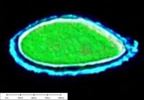
Akiaki Atoll - Landsat Image S-07-15_2000 (1:10,000)
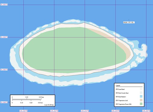
Akiaki Atoll - Marplot Map (1:10,000)
Akiaki (Aki Aki, Thrum Cap) [1790] (18˚33'S., 139˚13'W.), NW of Vahitahi, is a small island of coral formation. There is a landing on the NW side that is difficult. (SD Pub-126)
Group: Centre East Group
Archipelago: Tuamotu Archipelago
Country: France - French Polynesia - Tuamotu Is.
Region: Oceania 18
Lat: 18.56º S Long : 139.21º W
Area: 1.3 sq. km Altitude: ? m
Depth to nearest land: 3000 m
Nearest island: 43.4 km @ 123° (Atoll Vahitahi)
Group: 940 km
Nearest continent: South America
Distance: 5500 km Isolation Index: 112
ISLAND TYPE: low coral Natural Protection Indicator: 2
CLIMATE: tropical
CATASTROPHIC THREATS: cyclones Threat Indicator: 1
ECOSYSTEMS: Coconuts, fringing reef Number of Ecosystems - Terrestrial: 1 Marine: 1
Percent shoreline: Coral Reef: 99% Mangrove: 0%
HUMAN OCCUPATION: Uninhabited, visited occasionally
Population: 0
Density: 0.0 persons/sq. km
Major Human Activities: coconut plantations
Percent population in agr/mining/fishing: 17% Human Threat Indicator: 1
Gross Domestic Product: $ 7236 per capita Economic Pressure Indicator: 4
DATA RELIABILITY: Data Rel. Indicator: 1
HUMAN IMPACT INDEX HI: 5
CONSERVATION IMPORTANCE INDEX CI-Terrestrial: 5 Low
CI-Marine: 4 Low
Last updated: 27/02/89
This small island claims to be an atoll. It is reported to be visited occassionally to work the coconut trees that are planted on it. I believe that the populated island is Vahitahi and these are the people that visit Akiaki. There is still hope for the nomadic lifestyle.
Enjoy!
Labels: atoll, EVS, Global Mapper, island, Landsat, map, Marplot, Pacific, Polynesia, Tuamotus
posted by Mr Minton at 10:46 AM
![]()


0 Comments:
Post a Comment
<< Home