Vairaatea Atoll FP
Wednesday, December 27, 2006
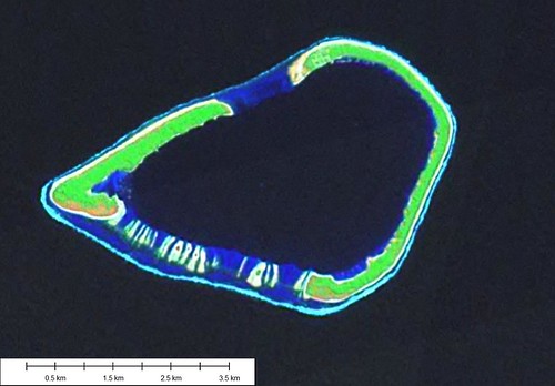
Vairaatea Atoll - Landsat Image S-07-15_2000
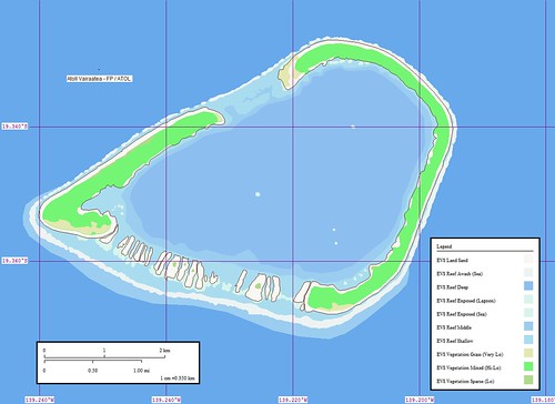
Vairaatea Atoll - Marplot Map
Vairaatea Atoll (19˚21'S., 139˚13'W.) is comprised of islands joined by a barrier reef surrounding a lagoon. The surf is heavy and landing is difficult; the usual place is near a shed with a flagstaff situated on the NW end of the atoll. There is a village on the atoll's NW.
Vahitahi is an atoll located about 29 miles N of Nukutavake. The lagoon is not accessible from the sea. The shores of Vahitahi are steep-to except the S part, which should not be approached within 0.3 mile. A village lies on the atoll's W end. (SD Pub-126)
I did come across an accout by Moshe Rappaport's visit to Vairaatea Atoll in 1989. At the time of his visit there were a total of eight families living on the island. He spoke of docking at a pier. On the main island (NW tip) is the village. Their looks to be a small harbor and a feature that I called a EVS Reef. Yet it could be a pier. Although there is no reported entrance into the lagoon for larger vessels. One can come ashore in a motor boat or a Zodiac.
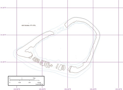
Vairaatea - Outline BW
I am throwing in an outline map of the island. Any of my digitized layers can be turned off. This keeps the EVS Shoreline and converts the EVS Reefs into blue lines. This is a nice map to work with to plot observations.
I have been working on this project for the past 4-hours. It is late and I am tired. Good nite!
Enjoy!
Labels: atoll, EVS, Global Mapper, island, Landsat, map, Marplot, Pacific, Polynesia, Tuamotus
posted by Mr Minton at 10:32 AM
![]()


0 Comments:
Post a Comment
<< Home