Clipperton island FR
Tuesday, December 26, 2006

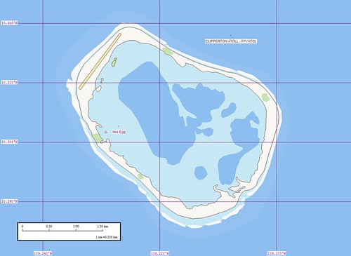
Clipperton Island - Marplot Map (1:25,000)
It has been some time since I was able to post a completed island. It seems that Blogger is running a bit on the slow side. Anyway, here goes a new post. Clipperton Island is known as a great sport fishing destination. It is also home to a weird tale about a king and his unwilling court. You can find out about that story at other places on the Internet.
The map was a challenge to create. Using MARPLOT and non-copyright images, I was able to create the map. The Landsat image was very course. In addition, cloud cover obscured parts of the island. Through mapping diligence and keen eyesight, I was able to complete the above project. I think it looks just fine.
Enjoy!
Labels: atoll, EVS, France, Global Mapper, island, map, Marplot, Pacific
posted by Mr Minton at 2:19 PM
![]()


0 Comments:
Post a Comment
<< Home