Vahitahi Atoll FP
Tuesday, December 26, 2006
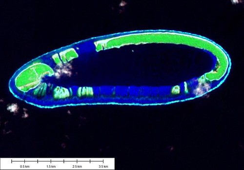
Vahitahi Atoll - Landsat Image S-07-15_2000
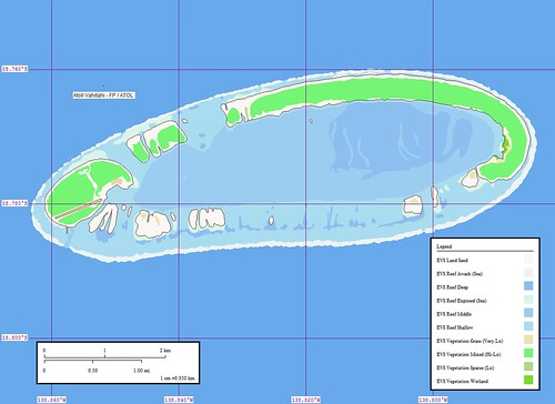
Vahitahi Atoll - Marplot Map
Vahitahi Atoll (138 50'W 18 35'S) is an atoll located about 29 miles N of Nukutavake. The lagoon is not accessible from the sea. The shores of Vahitahi are steep-to except the S part, which should not be approached within 0.3 mile. A village lies on the atoll's W end. (SD Pub-126)
Vahitahi Atoll is located in the eastern part of the Tuamotu Archipelago, about 50 kilometres to the north of Nukutavake, and historically the most densely settled atoll in the eastern part of the archipelago.
250 hectares in area, Vahitahi is just under 5 kilometres from west and east, and 1½ kilometres from north to south. Apart from its southern side, where there is a low reef, the atoll has little vegetation.
It has a shallow lagoon with coral above sea level in many places and no entrance to the sea. It was this feature of the atoll that led to Cook naming it 'Lagoon Island'.
The first Europeans to see the atoll were the voyagers commanded by Louise-Antoine de Bougainville (1729-1811) in March 1768.
Today the atoll has around 70 inhabitants and is part of the Commune of Nukutavake in the Tuamou-Gambier administrative subdivision of French Polynesia.
http://nla.gov.au/nla.cs-ss-biogs-P000330
Group: Centre East Group
Archipelago: Tuamotu Archipelago
Country: France - French Polynesia - Tuamotu Is.
Region: Oceania 18
Lat: 18.58º S Long : 138.83º W
Area: 0.0 sq. km Altitude: ? m
Depth to nearest land: 3000 m
Nearest island: 45 km group: 980 km
Nearest continent: South America
Distance: 5400 km Isolation Index: 111
ISLAND TYPE: atoll Natural Protection Indicator: 2
CLIMATE: tropical
CATASTROPHIC THREATS: cyclones Threat Indicator: 1
ECOSYSTEMS: Coconuts on west, east bare; windward and leeward atoll reefs and closed lagoon Number of Ecosystems - Terrestrial: 1 Marine: 3
Percent shoreline: Coral Reef: 99% Mangrove: 0%
HUMAN OCCUPATION: Uninhabited, ?
Population: 0
Density: 0.0 persons/sq. km
Major Human Activities: coconut plantations
Percent population in agr/mining/fishing: 17% Human Threat Indicator: 1
Gross Domestic Product: $ 7236 per capita Economic Pressure Indicator: 4
DATA RELIABILITY: Data Rel. Indicator: 1
HUMAN IMPACT INDEX HI: 5
CONSERVATION IMPORTANCE INDEX CI-Terrestrial: 5 Low
CI-Marine: 5 Moderate
Last updated
: 27/02/89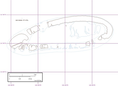
Vahitahi Atoll - Marplot Map Outline
And finally, here is an outline map of the island. It also shows the various reefs. My favorite is the outline map. I suspect that the reader would prefer the color map or the image. The outline is the ultimate map. As an end user, I can take it and add my own unique information. In my opinion, it offers the greatest flexibility.
Enjoy!
Labels: atoll, EVS, Global Mapper, island, Landsat, map, Marplot, Pacific, Polynesia, Tuamotus
posted by Mr Minton at 11:54 AM
![]()


0 Comments:
Post a Comment
<< Home