Iles de Los GV
Tuesday, December 26, 2006
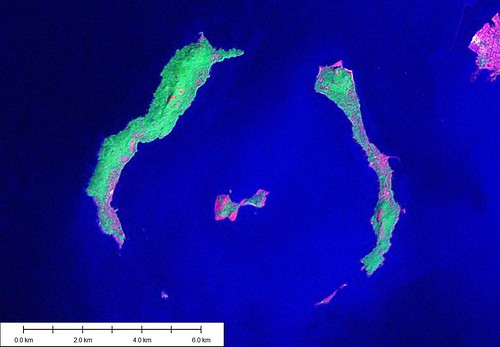
Iles de Los - Landsat Image N-28-05_2000 (1:62,500)

Iles de Los - Marplot Map (1:62,500)
Outside of Conakry, Guinea is this group of islands. They were home to British colonialists back in the late 19th century. Now it is home to tourists and the Guinean entrepreneur. At World 66 are a couple of images of Iles de Los beaches.
The red in the Landsat image is where people live. And what's the big deal, you say. Well, they are living on the edges of a volcano. I don't care if it is dorminant, it is still the edge of a volcano. Okay for a visit, but a bad choice for a home.
The islands were used by slavers back during the time of slaves and slavers.
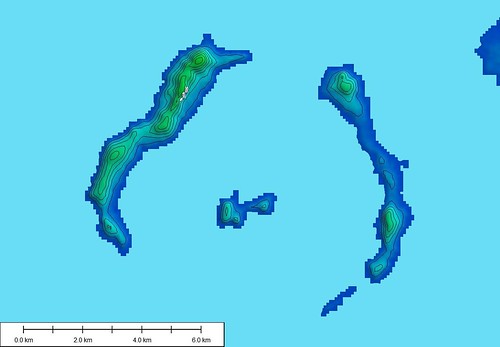
Iles de Los - SRTM Contours 20-m Intervals
This is the SRTM image (N09W014.hgt.zip) that I used for contour generation. It loads into Global Mapper and contour generation is an easy operation.
Enjoy!
Labels: Africa, Atlantic, EVS, Guinea, island, Landsat, map, Marplot
posted by Mr Minton at 11:16 AM
![]()


0 Comments:
Post a Comment
<< Home