Tehuata Atoll FP
Wednesday, December 27, 2006
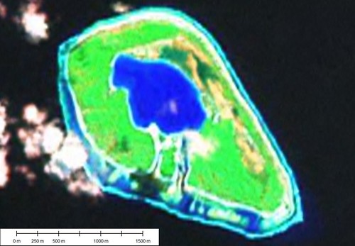
Tehuata Atoll - Landsat Image S-07-15_2000 (1:15,625)
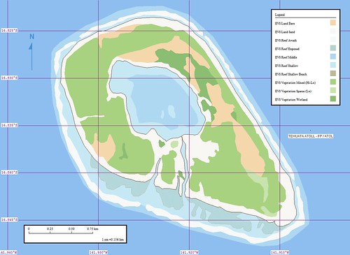
Tehuata Atoll - Marplot Map (1:15,625)
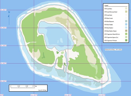
Tehuata Atoll aka Rekareka Atoll is small in comparison to it's neighbors. According to the UN Island Directory entry for Rekareka Atoll the island is uninhabited. Most probably the island is visited to harvest copra. The digitizing was fast and uncomplicated. GE has a 1-meter resolution image available for this island. I might use it later. I did a quick comparison and find that what I mapped is good.
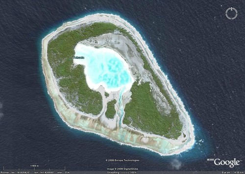
Tehuata Atoll - Google Earth Image (1-15,125)
Tehuata Atoll - Marplot Map (1-15,125)
Okay, I am a perfectionist. I couldn't leave the map alone. Using the Google Earth 1-meter resolution imagery as base, I checked out my original vectors. A few minor adjustments. The primary change was a layer classification. I renamed EVS Land Gravel Sand, which I used once on Caldey Island UK, to EVS Land Distressed Sand. I believe that the grey sandy portion of the island is salt-water saturated. I like distressed sand instead of water saturated sand. Lots of things can distress sand besides water. And since it is my map, that is what I will continue to call it.
Enjoy!
Labels: atoll, Digital Globe, EVS, Global Mapper, Google Earth, island, Landsat, map, Marplot, Pacific, Polynesia, Tuamotus
posted by Mr Minton at 10:22 AM
![]()


0 Comments:
Post a Comment
<< Home