Ahunui Atoll FP
Wednesday, December 27, 2006
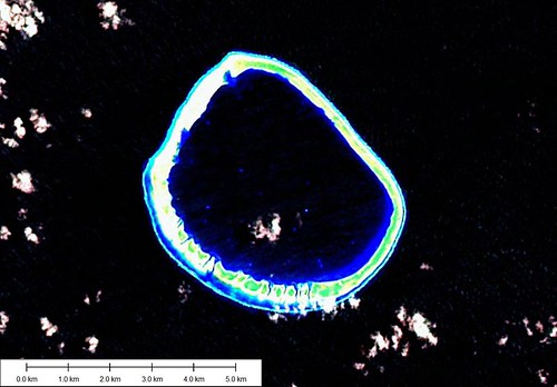
Ahunui Atoll - Landsat Image S-07-15_2000 (1:50,000)
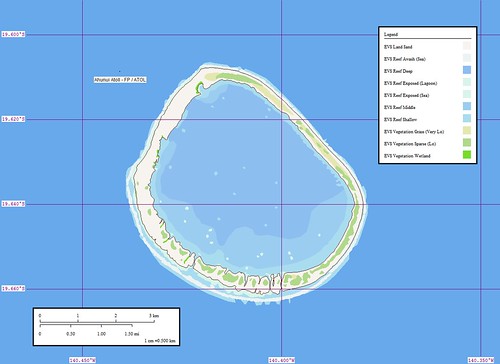
Ahunui Atoll - Marplot Map (1:50,000)
Ahunui Atoll (Ahounoui, Byam Martin, Cockburn)is an uninhabited wooded atoll. The lagoon is in-accessible, but there is a landing place on the NW end of the atoll near some huts and a tank. (SD Pub-126)
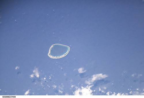
Ahunui Atoll - ISS Image ISS006-E-37449
This atoll does not have much information posted on the Internet. The Sailing Directions give very little information. The Shuttle Image shows a vegetation area on the western motu that the Landsat image does not show. The Landsat image appears to be washed out (if that can be possible with satellite imagery).
I spent about four hours digitizing the shoreline of this atoll. It was a fairly simple process.
Enjoy!
Labels: atoll, EVS, Global Mapper, island, Landsat, map, Marplot, Pacific, Polynesia, Tuamotus
posted by Mr Minton at 10:59 AM
![]()


0 Comments:
Post a Comment
<< Home