Rawaki Atoll KR
Wednesday, December 27, 2006
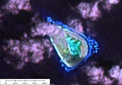
Rawaki Atoll - Landsat Image S-02-00_2000 (1:12,500)
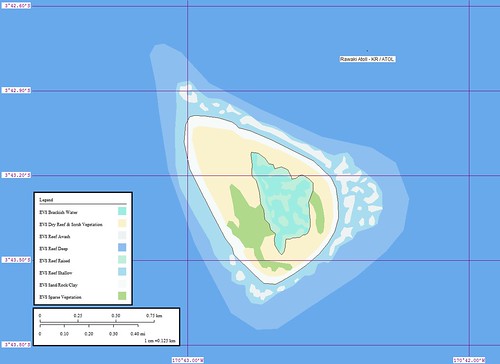
Rawaki Atoll - Marplot Map (1:12,500)
Rawaki Atoll (3˚43'S., 170˚43'W.) aka Phoenix Island is a treeless, triangular, coral atoll surrounded, except for the middle third of the W or longest side, by a wide platform reef. The reef bares at LW. Depths of less than 9.1m are found within 0.25 mile of the SE and NE sides. Shoals, which break heavily, extend about 0.4 mile off the NW end of the island. The land rim is about 4.9m high, 30m inshore from the reef. The first rise is covered with loose coral fragments washed in from the sea. The island is uninhabited. It is a wildlife sanctuary. Phoenix Island has been reported to give good radar returns up to 11 miles.
Winds—Weather.—Winds are always E. Usually, they vary from ENE to ESE, with the latter predominating.
Tides—Currents.—The current sets strongly past the N and S points of the island, converging on the W side. Close in to the shore on the W side of the island, the flood sets N and the ebb sets S. Offshore, the set is W about 0.5 knot, varying in strength and direction with the surface currents set up by the prevailing wind. (SD Pub-126)
This took about 1-hour to digitize, convert into a map, copy images, post to Flickr and finally post to EVS-Islands. The northwestern part of the island is obscured by clouds. I could detect the faint outline of the island proper, but I guessed on the shape of the beach.
Enjoy!
Labels: atoll, EVS, island, Kiribati, Landsat, map, Marplot, Pacific, Phoenxi Islands
posted by Mr Minton at 11:15 AM
![]()


0 Comments:
Post a Comment
<< Home