McKean Atoll KR
Wednesday, December 27, 2006
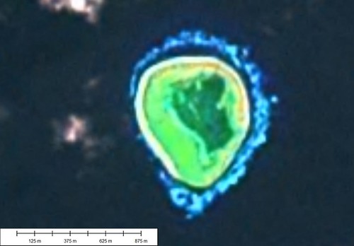
McKean Atoll - Landsat Image S-01-00_2000 (1:10,200)
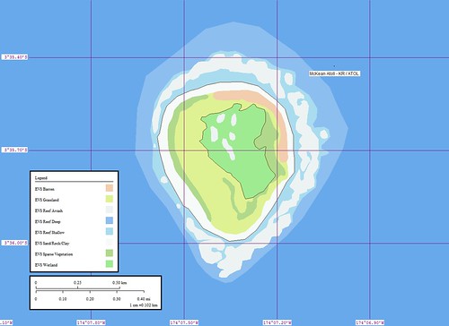
McKean Atoll - Marplot Map ()1:10,200)
McKean Island (3˚36'S., 174˚08'W.) is a treeless coral island, nearly 0.5 mile round in shape, set on a heart-shaped reef. Breakers extend about 0.3 mile from the N end and 0.2 mile from the S end of the island. The most conspicuous object on the island is the ruin of a large building on the W side, with a coral slab, 2.1m high. Scattered about are the ruins of several structures, obviously part of the old guano works. The island is a wildlife sanctuary.
Winds—Weather.—The winds are nearly always E, varying from NE to ESE, with the former predominating.
Tides—Currents.—The current sets strongly past the N and S points, converging on the W side of the island. Close in to the shore on the W side, the flood sets N and the ebb S. Offshore, the set is W with an average velocity of 0.5 knot, but varying in strength and direction with the prevailing wind. (SD Pub 126)
I mapped this island because of a reference to it in the Atoll Research Bulletin. This map took about 1 hour to complete and post. It's lagoon is classified as a EVS Wetland, because I don't have an appropriate layer designation yet for a lagoon of this nature. It is mostly full of salt tolerant vegetation and rubble. At high tide the lagoon has ocean water percolate into it. Atoll Research Bulletin 228 contain some interesting information about a brief scientific expedition to the island back in 1968. The information is still relevant.
Enjoy!
Labels: atoll, EVS, island, Kiribati, Landsat, map, Marplot, Pacific, Phoenix Islands
posted by Mr Minton at 11:22 AM
![]()


0 Comments:
Post a Comment
<< Home