Tepoto Island FP
Tuesday, December 26, 2006
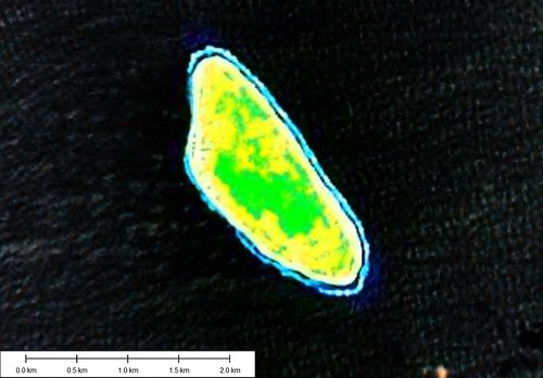
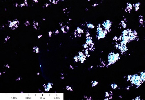
Tepoto Island - Landsat Image S-07-10_2000
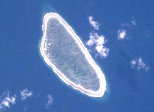
Tepoto Island - ISS Image ISS002-E-8862
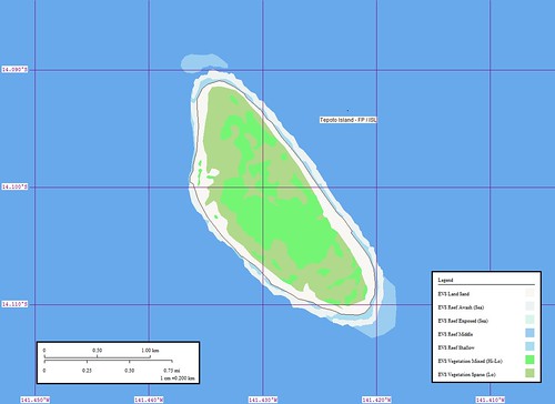
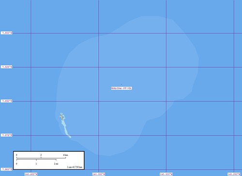
Tepoto Island - Marplot Map
Tepoto Island (14˚03'S., 141˚25'W.) about 10 miles NW of Napuka, is about 18.3m high to the top of the trees; it is the NW island of the Iles du Desappointement. Landing is practicable, with assistance of the natives, on the W side of the island. (SD Pub-126)
From Wikipedia: Tepoto, a coral island, is the northwesternmost of the Disappointment Islands, in the Tuamotu Archipelago, located at 14° 8' S lat and 141° 24' W long. The island is sometimes called Tepoto Nord in French, to avoid confusion with the Tepoto atolls 400 km (240 mi.) to the southwest in the Raeffsky Islands of central Tuamotu. According to the 2002 census, its population was 54 inhabitants. The primary village is Tehekega.
From IRD: Northern Tepoto which is one of the North-Eastern Tuamotu islands, is situated 16°48' south and 144°19' west, 16 km to the north-west of Napuka. This is one of the high atolls, or "makateas", with a dry lagoon: the solid ground thus forms an island 2.6 km long and 800 m wide. Tepoto. is surrounded by a barrier reef. There is a road 5m wide running round the whole atoll. The village of Tehekega in the nord-west of the atoll can be reached by taking one of the whale-boats which call in at a jetty 28 m long and 4.5 m wide. This atoll has an area of 400 hectares.
Northern Tepoto, which was discovered by John Byron in 1765, has had very few contacts with the Western world. In 1988, the population of the island consisted of only 62 inhabitants (there were 67 in 1983).
Northern Tepoto belongs to the commune of Napuka
From UNEP: Tepoto Nord [1761]
Group: Centre West Group
Archipelago: Tuamotu Archipelago
Country: France - French Polynesia - Tuamotu Is.
Region: Oceania 18
Lat: 14.º S Long : 141.33º W
Area: 2.05 sq. km
Altitude: 18.3 m (to tree tops)
Depth to nearest land: 3000 m
Nearest island: 16.5 km (110º) Napuka
Group: 420 km
Nearest continent: South America
Distance: 6100 km Isolation Index: 102
ISLAND TYPE: atoll Natural Protection Indicator: 2
CLIMATE: wet tropical
CATASTROPHIC THREATS: cyclones Threat Indicator: 1
ECOSYSTEMS: Windward and leeward atoll reefs, open lagoon Number of Ecosystems - Terrestrial: 1 Marine: 3
Percent shoreline: Coral Reef: 99% Mangrove: 0%
HUMAN OCCUPATION: Inhabited
Population: 54 (2002 Census)
Density: 26.3 persons/sq. km
Percent population in agr/mining/fishing: 17% Human Threat Indicator: 1
Gross Domestic Product: $ 7236 per capita Economic Pressure Indicator: 4
DATA RELIABILITY: Data Rel. Indicator: 1
HUMAN IMPACT INDEX HI: 5
CONSERVATION IMPORTANCE INDEX CI-Terrestrial: 5 Low
CI-Marine: 5 Moderate
Last updated: 25/02/89
Looking at the island image and the type of vegetation scattered about, it is difficult to image 54 people living on this small island. Are they primarily fishermen? Do they grow gardens? Do they go shopping at Napuka (10 miles SE)?
Enjoy!
Labels: atoll, EVS, Global Mapper, island, ISS Image, Landsat, map, Marplot, Pacific, Polynesia, Tuamotus
posted by Mr Minton at 11:46 AM
0 comments
![]()